
Understanding Bahamas Weather: When Is Hurricane Season?
Reading the Tides: Understanding Bahamas Weather at Big Major Cay
Out here on the shallow waters of the Exuma Cays, weather is not something you skim off a phone screen before pulling on your boots. It is the raw hand that governs whether my skiff leaves the dock at Staniel Cay or stays tethered tight. My green parrot Sloop sits on the cabin roof with his head cocked toward the south when a squall brews twenty miles off, long before any radar screen picks up the moisture. If you plan a journey to see the swimming pigs on Big Major Cay, learning to read the sky is as important as knowing how to handle a tiller.
The Bahamian archipelago stretches across seven hundred islands and thousands of small cays, shaped by two overarching climatic rhythms. We do not have four distinct seasons like the northern mainland. Instead, our year splits into a dry, stable winter stretch and a warm, humid summer season marked by tropical convection. Understanding how these water and air currents move across the shallow Bahama Banks helps you decide when to step aboard an open boat and when to stay ashore. For detailed advice on packing and island accommodations, review our guide on practical trip planning.
“The sea gives warning to anyone willing to listen. Watch the wind direction before you watch the clock, because the pigs won’t swim out to meet a skiff when the swell turns against teh beach.”
— Captain Elias Thorne
Hurricane Season Demystified: Dates, Peak Danger, and Forecasts
The official Atlantic hurricane window opens on June 1 and extends through November 30 each year. Tropical low-pressure systems form off the coast of West Africa and track west across the warm equatorial ocean. Early summer brings brief afternoon showers that pass within twenty minutes, leaving behind clear blue skies. The real shift in ocean behavior occurs as surface water temperatures rise during mid-summer.
August, September, and October represent the peak window for significant storm development in the Exuma Cays. Ocean temperatures hit their warmest levels of the year, providing energy for tropical depressions, tropical storms, and major hurricanes. Statistical peak activity centers around September 10. During these weeks, sudden atmospheric shifts can turn a calm morning run into a rough crossing, making constant weather checks essential for anyone heading out to see the herd.
Understanding a pig beach bahamas hurricane forecast requires separating broad regional predictions from what happens on the water daily. While the Bahamas sits directly within the Atlantic storm track, direct landfalls on Big Major Cay occur on average once every five to six years. Many systems curve north into the open Atlantic or pass south toward the Caribbean sea without directly impacting the Central Exumas.
Local caretakers and boat operators take active measures when severe weather threatens. In discussions regarding pig beach bahamas after dorian, visitors often ask how the animals survive powerful storms. The feral colony on Big Major Cay has natural sheltered high ground inside the island interior, and local handlers from Staniel Cay move feed, fresh water, and extra protection onto the cay prior to major storm arrivals. Real-time updates should always be monitored through official bulletins at the National Hurricane Center and the Bahamas Department of Meteorology.
Pig Beach Through the Months: Dry Gold Standard vs. Summer Rains
Mid-December through April represents the dry season gold standard for visiting Big Major Cay. Daytime air temperatures average between 70°F and 80°F (21°C to 26°C) with low humidity and predictable easterly trade winds. Water clarity reaches its peak, and sea conditions remain favorable for small boat charters running from Staniel Cay or Great Exuma. You can review boat routes and flight options in our detailed guide on how to get to Pig Beach.
Travelers considering pig beach bahamas weather christmas time will find mild temperatures and excellent sailing conditions. Late December brings crisp morning breezes and calm turquoise seas, though high demand means boat charters must be secured months in advance. The winter months feature stable atmospheric pressure, making long crossings across the Exuma Sound far smoother than in late summer.
Summer months from June through November bring a diferent rhythm to the cays. Daytime temperatures routinely reach the upper 80s and low 90s (31°C to 34°C) with high humidity levels. Thunderstorms build quickly over the warm banks during afternoon hours, often dumping heavy rain for thirty minutes before burning off under intense sunlight. These sudden squalls can produce steep chop in open water channels.
Extreme summer heat also changes pig behavior on the beach. During hot afternoon hours, the animals retreat into the dense brush along the island interior to stay cool, swimming less frequently than they do during cooler morning hours. Visitors who travel in summer should schedule early morning boat trips to catch the pigs while they remain active along the shoreline. Remember to follow ethical guidelines covered in our visitor rules and guidelines when interacting with the herd.
Local Barometers and Marine Sky Reading
Long before electronic barometers existed, Bahamian captains relied on natural signals to read upcoming changes in the weather. A key indicator in the Exumas is a shift in wind direction. When the prevailing easterly trade winds drop and turn toward the south or southwest, moisture accumulation usually follows within twenty-four hours. A glass-calm morning accompanied by heavy, humid air often signals an afternoon squall brewing over the banks.
Cloud structures tell an equally clear story. High cirrus clouds spreading in feather-like patterns from the west signal upper-level atmospheric instability. When tall cumulus clouds begin building dark, flat bottoms over the shallow waters near Staniel Cay, rain is imminent. Watching how seabirds behave near the cay provides another reliable barometer, as gulls and terns seek shelter along lee shores hours before a wind shift hits the water.
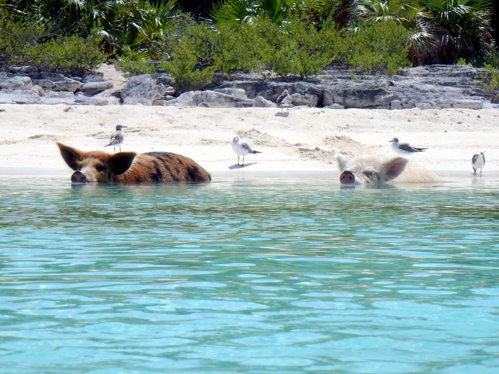
Sea state on Big Major Cay depends directly on wind angle. The swimming pig beach lies on the western, sheltered side of the island. When normal easterly winds blow, the beach remains calm and protected. However, a westerly or northwesterly wind pushes waves directly onto the shore, creating rough surf that makes beach landings difficult and keeps the pigs from entering the sea safely.
Practical Logistics, Insurance Anchors, and Month-by-Month Decision Matrix
Planning a trip across open water during tropical storm season requires flexibility and real contingency planning. Open-boat tour operators will cancel crossings when wave heights exceed safe limits, and regional air carriers frequently delay flights when severe squalls pass over the runways. Building two or three flexible days into your vacation timeline gives you room to reschedule a canceled boat excursion without missing the chance to visit Big Major Cay altogether.
Comprehensive travel insurance serves as a vital safeguard between June and November. Look for policies that include explicit coverage for weather disruptions, named tropical storms, and trip cancellations caused by mandatory evacuation orders. Securing insurance with flexible cancellation terms allows you to adjust accommodations or flight itineraries if a system tracks toward the Exuma chain, making your financial investment far safer to hold onto.
| Month Range | Average Air Temp | Sea Conditions | Rainfall Risk | Overall Travel Profile |
|---|---|---|---|---|
| December – April | 70°F – 80°F (21°C – 26°C) | Calm to moderate swell | Low | Peak dry season; optimal boating; higher accommodation prices |
| May – July | 82°F – 88°F (28°C – 31°C) | Generally smooth waters | Moderate (afternoon showers) | Warm weather; active pigs; good balance of conditions and crowds |
| August – October | 85°F – 90°F (29°C – 32°C) | Variable; tropical swell risk | High (peak storm window) | Off-peak season; lowest rates; requires flexible booking insurance |
| November | 75°F – 82°F (24°C – 28°C) | Settling sea conditions | Decreasing | Shoulder season transition; pleasant air temps; manageable crowds |
Respecting the weather in the Exumas means recognizing that the ocean always holds the final decision. Plan with flexibility, monitor official advisories, and the sea will reward your journey.
Whether you choose the crisp, dry days of mid-winter or decide to navigate the quieter shoulder months, understanding local weather patterns ensures a safe and memorable journey to Big Major Cay. To explore how the island colony came to inhabit this cay in the first place, read our deep dive into the history and origins of Pig Beach. Pay attention to the wind, keep an eye on the horizon, and listen when local captains share their knowledge of the tides.